


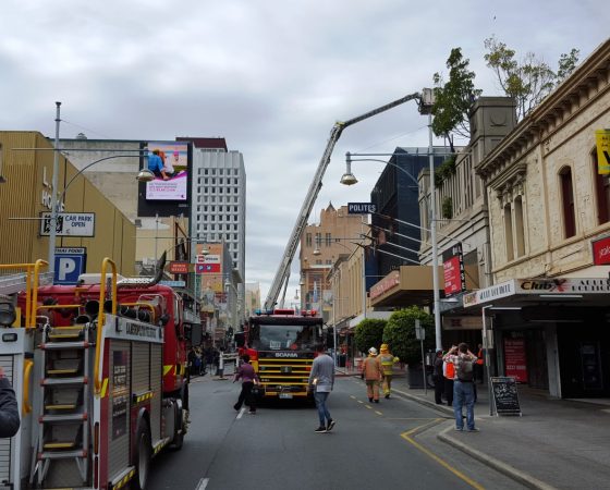

We’ve all seen it – fire engines and units racing down the streets, weaving through (or competing with) traffic – and they don’t know what they are going to get until they get there! So, by using the PROWL capabilities to plan a path from a station or depot to the location of the suspected incident, an automated drone can get there quickly and send back pictures of the crash, fire or other problem – allowing the fire service to send the right number and type of units.
With an autonomic drone, sent out to the incident scene rapidly, the emergency services can get a direct (aerial) view of the location. However, if getting the drone to the site requires a licensed pilot to have line of sight (FAA Rule 107, CASA (Australia) Part 101, CAA (UK) Article 94.3), or the drone could itself cause an accident by hitting obstacles, this requires that there is a change to deployment – the need to send a car or van to the site, with the drone and it’s pilot.
These rules exist, because there are no trustworthy alternatives to a person keeping a line of sight on the UAV / RPA, ensuring that it avoids obstacles. However, with PROWL, these laws and regulations could be modified to allow for autonomous drones that utilise a reference database of known hazards.