


Surveys of topology can require that a drone flies in a programmed survey grid pattern. Systematic flight plans need to be automated, but there is always the risk that the drone could hit an unexpected obstacle like a large tree, or the support wire for a mast or antenna. Using PROWL, the drone operator can be more confident that their vehicle will be safe from hitting known obstacles.
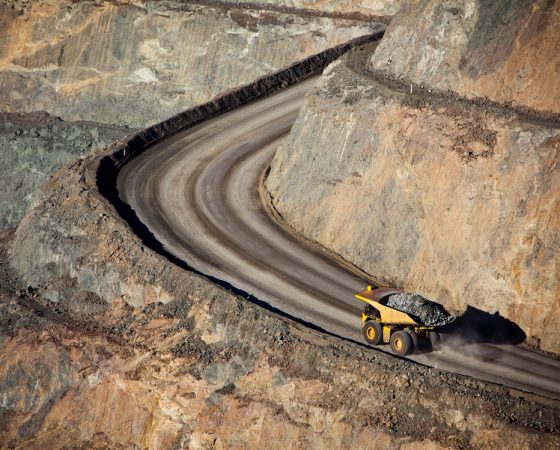
Even in remote areas, by using the crowd sourced architecture of the PROWL system, hazards can be created by any user. So, for remotely controlling a 300 ton truck along an open cast mine, the mine operator could specify the edges of the track as temporary hazard objects, tag them as such, and then allow the truck to follow an automated path. If the truck is able to detect a temporary hazard, such as soft ground – or a dropped tool, then the truck could avoid the obstacle within the parameters of the known hazards to avoid. As each user-submitted hazard polygon is still owned by that user, the operator could change the hazard when the track moves.
For surveying, the PROWL system allows for object polygons to be tagged with information about the object. This is both the categorisation of the hazard, and tags or attributes about the object. This has endless possibilities, where a rock outcrop can be recorded for it’s location and 3D shape, and the rock type and survey date, types of birds nesting, varieties of plant life, etc.
Using a pooled database of exposed data from other providers, the PROWL system can also draw upon other data sources, obtaining live information from multiple sources. Combining geological information with topological information, water course and plant life, power lines and pipelines – all accessible through a single lookup.