


We’ve all seen it – police and fire engines racing down the streets, weaving through (or competing with) traffic – and they don’t know what they are going to get until they get there! So, by using the PROWL capabilities to plan a path from a station or depot to the location of the suspected incident, an automated drone can get there quickly and send back pictures of the crash, fire or other problem – allowing the emergency services to send the right number and type of units.
Using information made available through the PROWL system, a drone can be programmed to follow a search pattern to look for a missing child, with it’s camera looking at the ground, but at the same time being aware of objects such as wires, large trees, ground topography and other hazards that are made available through the PROWL system’s access to crowd sourced data and also external 3rd party data sources.
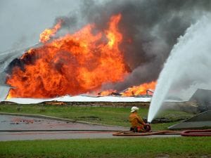
Official organisations can benefit from the hazard database, and choose to ignore requests for privacy. In this way a search grid can include properties that have requested no fly over, and fire survey drones can also access the same area. In the event of a short-term hazard – such as a forest fire / wildfire / bushfire, the entire zone can be marked as a temporary no-fly zone to ensure that private drones do not interfere with the flight path of firefighting aircraft. The same can be performed in a hostage situation, terrorist threat or other situation where police or authorities can specify an area to request that drones do not enter the area.